Geographic Center of Boston

Boston is a very large spread out city with 23 neighborhoods. From Charlestown to Hyde Park, and Brighton to East Boston, the City of Boston is very well spread out. There are 850 miles of city streets across Boston.
The largest length, 13.8 miles is between the Suffolk Downs Infield of East Boston to Neponset River Reservation in Hyde Park.
The largest width, 7.75 miles, from Marine Park shore to the corner of Nonantume Street and Cuffins Street in Brighton.
Boston started small until it added towns under its belt. Over the years, it added different neighborhoods:
- 1637 - East Boston
- 1804 - South Boston
- 1868 - Roxbury
- 1870 - Dorchester
- 1874 - Charlestown, Brighton, West Roxbury
- 1912 - Hyde Park
Geographic Center of Boston
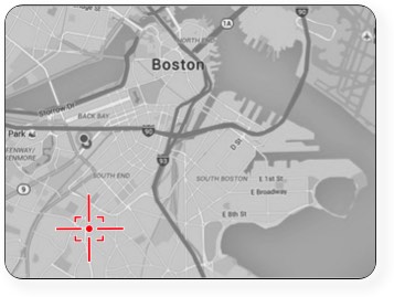
The center of Boston, Massachusetts is in Roxbury, far away from where people would associate being part of Boston.
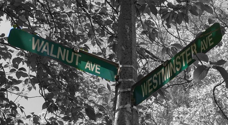
The exact location is at the corner of Walnut Avenue and Westminster Avenue in Roxbury.
This is a picture of the intersection looking East:

Should You Visit?
You will not find any special marker that this is the Geographic Center of the City of Boston. Basically taking pictures of the corner intersection is the only thing you can do to record your visit.
If you're looking for something different to do after a Sam Adams Brewery tour, it might be worth driving by just to say you visited and saw the Geographical Center of Boston. There's plenty of street parking for a quick picture.

Directions from Sam Adams
The corner of Walnut Avenue and Westminster Avenue is a five-minute drive from the Sam Adams brewery.
From the Brewery, head to Brookside Ave for .2 miles and then turn left onto Cornwall Street. Turn right on Washington Street then immediately take the first left onto Peter Parler Road. At the end of the road, take a left on Walnut Ave. About a 1/2 mile later you'll come to the Westminster Ave intersection.
Walnut Avenue & Westminster Avenue is a 15-minute walk from the Orange Line at the Stoneybrook - Outbound stop.
